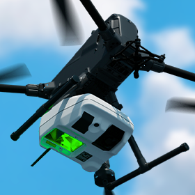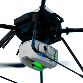
Drone Laser Scanner System "TDOT 3 GREEN"
A lightweight green laser system that is resistant to water absorption and capable of underwater surveying, suitable for surveying mountainous areas, river regions, and coastal areas.
In general drone laser surveying, near-infrared laser light is used. While near-infrared is inexpensive and easy to handle, it is easily absorbed by water and has a low reflectivity on black objects, which can result in a lack of surface data depending on the ground conditions as well as the underwater terrain. The TDOT 3 GREEN uses green laser light, which has a wavelength that can overcome the weaknesses of near-infrared. Like near-infrared, it can also be used for land surveying, allowing the TDOT 3 GREEN to perform both terrestrial and underwater terrain surveys with a single unit. ■ Seamless Kinematic Processing The TDOT series provides a system that automates optimal trajectory analysis using electronic reference points and fixed stations that require expertise, seamlessly integrating the entire process up to point cloud data output. ■ Real-Time Display of Survey Data The cross-sectional data during the survey can be checked in real-time, allowing for monitoring whether the surveying work is being conducted as planned.
- Company:amuse oneself.Inc
- Price:Other